Bus Stations in Amman
|
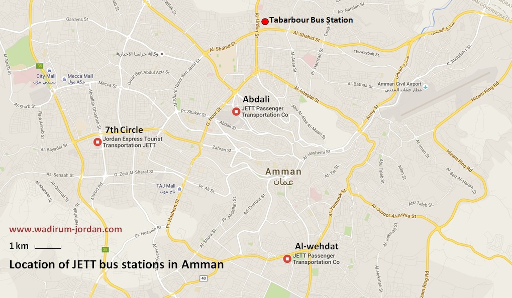
JETT buses travel from four bus stations in Amman: Abdali, 7th Circle, and Al-wehdat.
Click on the maps to enlarge. Finding bus stations in Amman -
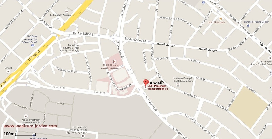
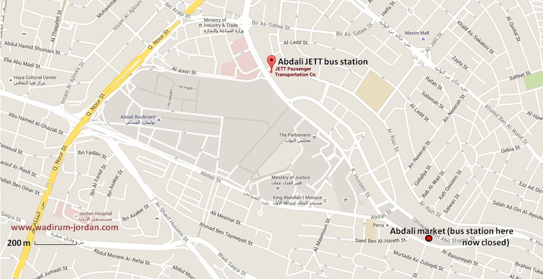
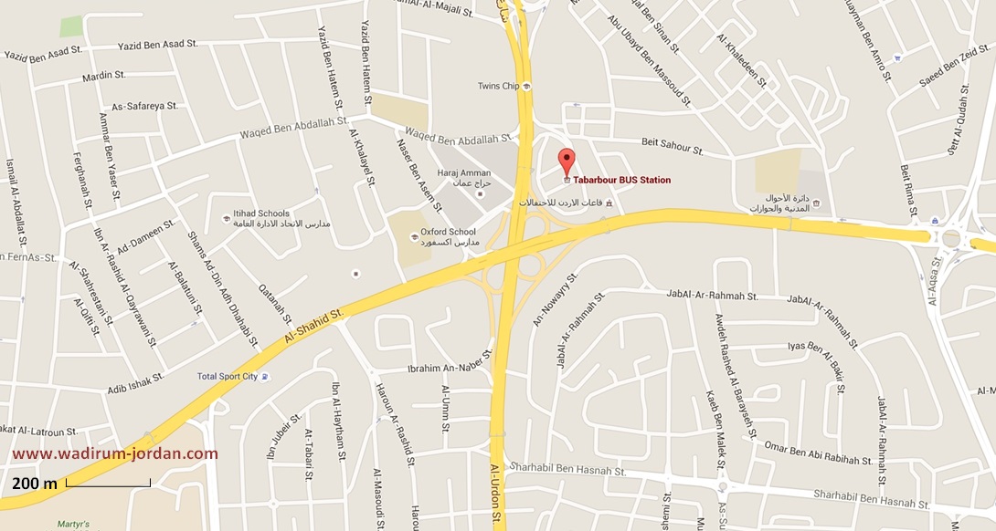
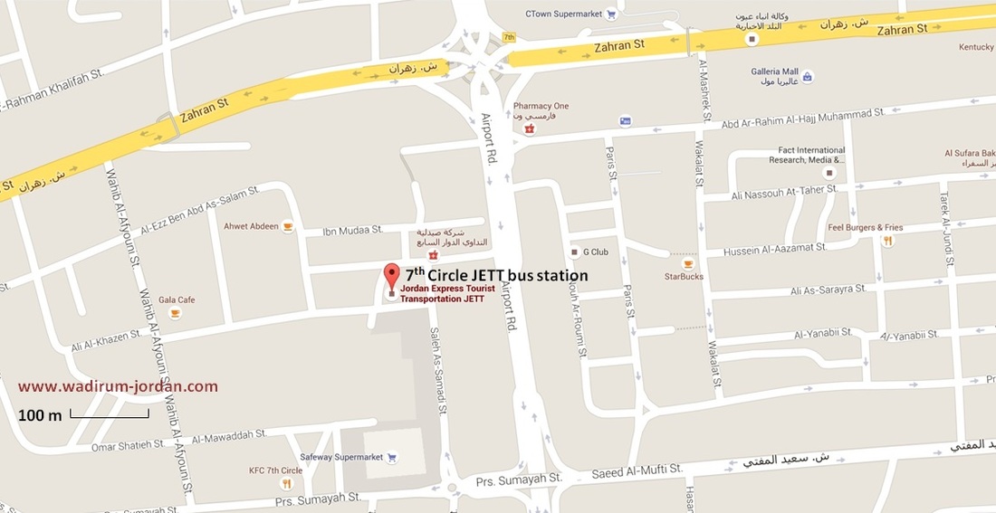
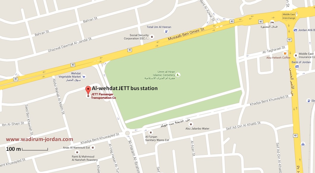
The detailed maps and addresses below are to help tourists get their bearings in Amman, to show you where the bus stations are in case you want to book a nearby hotel, and to help you get to Wadi Rum. Best advice: Ask your hotel manager to write the name of the bus station in Arabic on a piece of paper so you can show your taxi driver. Abdali JETT bus station (central) Robin Complex, King Al Hussein Street 224, Amman Phone number: +962 6566 4146 Coordinates: 31°58'01.3"N, 35°54'36.5"E or 31.967036, 35.910140 Confusion about the Abdali bus station. There are some posts on the internet saying that the Abdali bus station has closed. The Abdali JETT bus station as shown above is not closed. Another bus station, also called Abdali bus station (but for smaller buses) closed some years ago. This bus station was situated about 1 km SE of the Abdali JETT bus station, also on King Hussein Street. There was a market at the bus station on Fridays. Most of the smaller buses that used to leave from this station now leave from the Tabarbour bus station. The map below shows these two Abdali bus stations. Tabarbour bus station (north) Also known as the Northern Bus Station. This station is just NE of the Al-Urdon St and Al-Shahid St interchange. It is run by the Ministry of Transport. Coordinates: 31°59'41.0"N, 35°55'10.9"E or 31.994729, 35.919703 7th Circle JETT bus station (west) Complex No 8, Ibn Al Fata St 8, Amman Phone number: +962 6585 4679 Coordinates: 31°57'24.1"N, 35°51'22.9"E or 31.956695, 35.856360 Al-Wehdat JETT bus station (south) Complex No 4, Al Haram Al Ibrahimini St 4, Amman Phone number: + 962 64775663 Coordinates: 31°57'24.1"N, 35°51'22.9"E or 31.918332, 35.929844 Also known as 'Mujemma Al Janoob' bus station. This station is near the Wehdat Vegetable Market and the Umm al Hiran Islamic Cemetery. |
